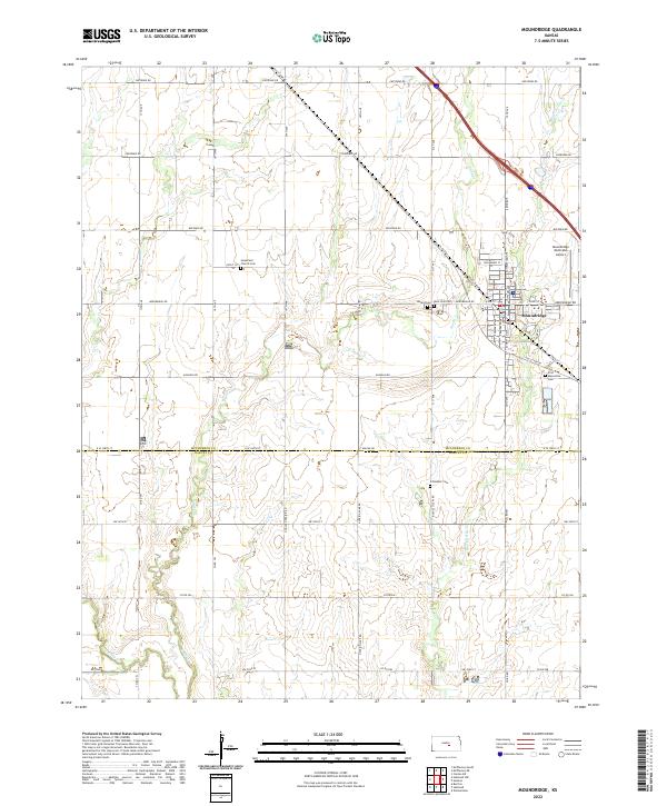
2022 Map of Moundridge
USGS Topo · Published 2022About this map
Moundridge serves as the central hub of this Central Kansas landscape, positioned where the McPherson Co and Harvey Co boundary line divides the agricultural plains. The area is defined by a dense network of section-line roads, including Cheyenne Rd and Cherokee Rd, which navigate the subtle drainage basins of Black Kettle Cr and Sand Cr. Cultural and genealogical interest is concentrated in the town's perimeter and surrounding townships, where sites like the First Mennonite Cem and Hopefield Church Cem reflect the region's deep-rooted denominational heritage. The infrastructure supporting the local economy is evident through the Moundridge Municipal Airport and the path of Old US Hwy 81, which parallels the modern interstate corridor. Smaller local landmarks, such as the Schlender Cem to the south, provide specific points of interest for family historians tracing early settlement patterns in this prairie region.
Find a feature on this map
31 named features on this map. Tap any name to fly to it.
Don’t see what you’re looking for? This feature index may not catch every label — zoom into the map to look around manually.
Map Details
Editions of this 2022 Moundridge Map
This is the sole edition of this map. No revisions or reprints were ever made.
Other maps of this area

1889 · Newton
USGS Topo · 1:125,000

1891 · Hutchinson
USGS Topo · 1:125,000

1893 · Hutchinson
USGS Topo · 1:125,000

1894 · Newton
USGS Topo · 1:125,000

1955 · Hutchinson
USGS Topo · 1:250,000

1959 · Hutchinson
USGS Topo · 1:250,000
1959 · Zimmerdale
USGS Topo · 1:24,000
1959 · Halstead
USGS Topo · 1:24,000
1959 · Burrton
USGS Topo · 1:24,000

1965 · Mc Pherson South
USGS Topo · 1:24,000