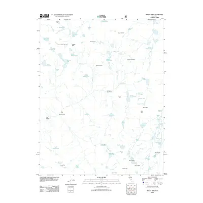
2012 Map of Mount Abbot
USGS Topo · Published 2012About this map
The High Sierra crest dominates this topographic survey, featuring some of California's most significant alpine terrain at the start of the 2010s. Centered on Mount Abbot, the map traces the drainage patterns of Mono Creek and its distinctive glacial basins, including the First, Second, Third, and Fourth Recess. This area of the Sierra National Forest is defined by high-altitude peaks such as Mount Stanford, Mount Huntington, and Mount Crocker, which wall off secluded water bodies like Grinnell Lake and Pioneer Basin Lakes. The map also captures the critical transit points for backcountry travel, such as McGee Pass and Mono Pass, alongside the small outpost at Fish Camp. The intricate network of lakes, from Big McGee Lake to the Hilton Creek Lakes, reflects the high-country hydrology of the Mono Creek watershed before modern climate shifts significantly altered these perennial alpine snowfields.
Find a feature on this map
70 named features on this map. Tap any name to fly to it.
Don’t see what you’re looking for? This feature index may not catch every label — zoom into the map to look around manually.
Map Details
Editions of this 2012 Mount Abbot Map
This is the sole edition of this map. No revisions or reprints were ever made.
Other maps of this area

1912 · Mt. Goddard
USGS Topo · 1:125,000

1914 · Mt. Morrison
USGS Topo · 1:125,000

1947 · Mariposa
USGS Topo · 1:250,000

1948 · Mariposa
USGS Topo · 1:250,000

1949 · Mt. Tom
USGS Topo · 1:62,500

1951 · Mt. Tom
USGS Topo · 1:62,500

1953 · Mt. Morrison
USGS Topo · 1:62,500

1953 · Casa Diablo Mtn
USGS Topo · 1:62,500

1953 · Mt Abbot
USGS Topo · 1:62,500
1954 · Mt. Tom
USGS Topo · 1:62,500