
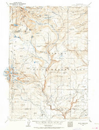
1904 Map of Mount Adams
USGS Topo · Published 1956About this map
The glacial systems of Mount Adams dominate this 1904 survey, documenting the early 20th-century landscape of the Yakima Indian Reservation and the surrounding national forests. The map illustrates a high-altitude wilderness defined by massive ice fields like the Adams Glacier and Rusk Glacier, feeding into the headwaters of the Klickitat River. Human activity at this time was concentrated in the lower elevations to the south and east, where the settlement of Glenwood served as a hub for local timber and ranching efforts.
Find a feature on this map
134 named features on this map. Tap any name to fly to it.
Don’t see what you’re looking for? This feature index may not catch every label — zoom into the map to look around manually.
Map Details
Editions of this 1904 Mount Adams Map
2 editions found
Other maps of this area

1899 · Ellensburg
USGS Topo · 1:125,000

1901 · Ellensburg
USGS Topo · 1:125,000

1902 · Mount Aix
USGS Topo · 1:125,000

1904 · Mt Aix
USGS Topo · 1:125,000

1907 · Mount Adams
USGS Topo · 1:125,000

1924 · Mt Rainier
USGS Topo · 1:96,000

1926 · Steamboat Mtn
USGS Topo · 1:125,000

1926 · Hood River
USGS Topo · 1:125,000

1928 · Mt Rainier
USGS Topo · 1:125,000

1929 · Hood River
USGS Topo · 1:125,000