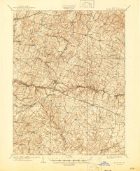
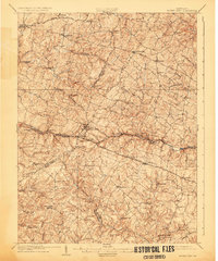
1909 Map of Mount Airy
USGS Topo · Published 1945About this map
The Baltimore and Ohio Railroad carves through the Maryland countryside on this early 20th-century survey, serving as a vital artery for transit between the rolling hills of Carroll and Howard counties. The settlement of Mount Airy serves as a central hub, while the landscape is defined by its water-powered industry, evidenced by numerous mills like Roxbury Mills, Hoods Mills, and Carrs Mill. These sites reflect a local economy still deeply tied to the drainage basins of the South Branch Patapsco River and the Patuxent River.
Find a feature on this map
73 named features on this map. Tap any name to fly to it.
Don’t see what you’re looking for? This feature index may not catch every label — zoom into the map to look around manually.
Map Details
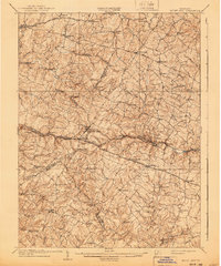
Editions of this 1909 Mount Airy Map
7 editions found

Other maps of this area

1892 · Laurel
USGS Topo · 1:62,500

1892 · Ellicott
USGS Topo · 1:62,500

1893 · Frederick
USGS Topo · 1:125,000

1894 · Ellicott
USGS Topo · 1:62,500

1894 · Laurel
USGS Topo · 1:62,500

1894 · Frederick
USGS Topo · 1:125,000

1897 · Laurel
USGS Topo · 1:62,500

1905 · Westminster
USGS Topo · 1:62,500

1906 · Ellicott
USGS Topo · 1:62,500

1907 · Laurel
USGS Topo · 1:62,500