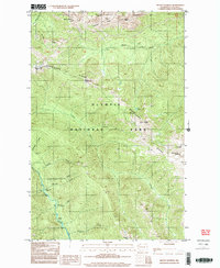
1999 Map of Mount Angeles
USGS Topo · Published 2003About this map
Mount Angeles and the surrounding high country of Olympic National Park are defined by a series of prominent ridges and deep river drainages. The Hurricane Ridge area serves as a focal point, featuring the Hurricane Ridge Visitors Center and the beginning of several major water systems. These include the Elwha River, which flows through the western portion of the map, and the Lillian River to the east. The terrain is marked by sharp geographic boundaries such as Klahhane Ridge and Sunrise Ridge, with individual landmarks like Steeple Rock and Eagle Point providing orientation. Along the river valleys, remote sites like Marys Falls Camp and Canyon Camp represent the established network of backcountry access points in this protected landscape. The drainage patterns of Morse Creek and Bauman Creek illustrate the complex watershed of the Olympic Peninsula.
Find a feature on this map
28 named features on this map. Tap any name to fly to it.
Don’t see what you’re looking for? This feature index may not catch every label — zoom into the map to look around manually.
Map Details
Editions of this 1999 Mount Angeles Map
This is the sole edition of this map. No revisions or reprints were ever made.
Other maps of this area

1918 · Port Angeles
USGS Topo · 1:62,500

1919 · Port Crescent
USGS Topo · 1:62,500

1935 · Mount Olympus
USGS Topo · 1:62,500

1938 · Mt Constance
USGS Topo · 1:125,000

1941 · Port Angeles
USGS Topo · 1:62,500

1942 · Mount Olympus
USGS Topo · 1:62,500

1944 · Mt. Angeles
USGS Topo · 1:62,500

1946 · Mt. Angeles
USGS Topo · 1:62,500

1950 · Elwha
USGS Topo · 1:24,000

1950 · Hurricane Hill
USGS Topo · 1:24,000