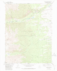
1983 Map of Mount Antero
USGS Topo · Published 1983About this map
Mount Princeton Hot Springs and the nearby Hortense Hot Spring highlight a landscape defined by geothermal activity and high-alpine terrain within the San Isabel National Forest. This 1983 survey records a region of intense elevation changes, anchored by the 14,197-foot summit of Mount Princeton and the mineral-rich slopes of Mount Antero. The mapping of numerous Prospects, mines, and quarries alongside established recreation sites like Chalk Lake Campground and Mount Princeton Campground illustrates the dual history of resource extraction and mountain tourism in Chaffee County. The high-altitude hydrology is well-documented, tracing Chalk Creek past the Chalk Cliffs to the Chalk Cliff Fish Hatchery, while Agnes Vail Falls marks a sharp descent in Cascade Canyon. A network of historic paths, including the Merriam Pack Trail and various jeep trails, provides insight into the rugged accessibility of these peaks during the late twentieth century.
Find a feature on this map
44 named features on this map. Tap any name to fly to it.
Don’t see what you’re looking for? This feature index may not catch every label — zoom into the map to look around manually.
Map Details
Editions of this 1983 Mount Antero Map
2 editions found
Other maps of this area

1940 · Garfield
USGS Topo · 1:62,500

1945 · Garfield
USGS Topo · 1:62,500

1955 · Buena Vista
USGS Topo · 1:62,500

1955 · Mount Harvard
USGS Topo · 1:62,500

1956 · Poncha Springs
USGS Topo · 1:62,500

1956 · Montrose
USGS Topo · 1:250,000

1959 · Montrose
USGS Topo · 1:250,000

1960 · Montrose
USGS Topo · 1:250,000

1968 · Montrose
USGS Topo · 1:250,000

1982 · Buena Vista West
USGS Topo · 1:24,000