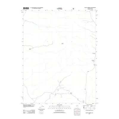
2011 Map of Mount Ardivey
USGS Topo · Published 2011About this map
Mount Ardivey serves as the central high point in this corner of Nye County, where the high desert landscape is defined by its intermittent water sources and transit corridors. The presence of Golden Spring and Cripple Spring indicates the critical importance of reliable water for ranching and travel in this arid environment. Lower elevations are marked by the Farrington Ranch and the winding course of Golden Wash, which leads toward the Golden Summit. The transportation network is sparse, consisting primarily of tracks that follow natural contours through Farrington Canyon and Merritt Canyon. This area represents a typical Great Basin ranching and recreation landscape of the early 21st century, where the Weeks Canyon Trailhead provides a modern access point into the deeper backcountry and the drainages of Cloverdale Creek and Cottonwood Creek.
Find a feature on this map
11 named features on this map. Tap any name to fly to it.
Don’t see what you’re looking for? This feature index may not catch every label — zoom into the map to look around manually.
Map Details
Editions of this 2011 Mount Ardivey Map
This is the sole edition of this map. No revisions or reprints were ever made.
Other maps of this area

1907 · Tonopah
USGS Topo · 1:250,000

1908 · Tonopah
USGS Topo · 1:250,000

1948 · Ione
USGS Topo · 1:62,500

1950 · Ione
USGS Topo · 1:62,500

1956 · Tonopah
USGS Topo · 1:250,000

1959 · Tonopah
USGS Topo · 1:250,000

1962 · Tonopah
USGS Topo · 1:250,000
1980 · Cloverdale Ranch
USGS Topo · 1:24,000
1980 · Black Spring NW
USGS Topo · 1:24,000

1980 · Secret Basin
USGS Topo · 1:24,000