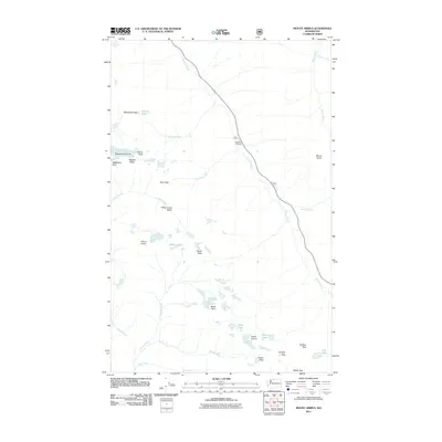
2011 Map of Mount Arriva
USGS Topo · Published 2011About this map
Mount Arriva and the high ridges of the North Cascades define this landscape at the start of the 21st century. The survey details a glaciated high-altitude environment where features like Mesahchie Glacier and Lewis Glacier persist near prominent summits including Mesahchie Peak, Kitling Peak, and Black Peak. A network of high-elevation crossings, such as Easy Pass, Heather Pass, and Maple Pass, connect the steep drainages of Fisher Creek and Granite Creek. The Easy Pass Trailhead serves as a primary access point into this remote terrain, which is characterized by permanent snowfields and small alpine water bodies like the Silent Lakes and Wing Lake. This map captures the topography of the region just as modern digital mapping standards were being refined, documenting the extent of ice and permanent snow during the late 2000s.
Find a feature on this map
34 named features on this map. Tap any name to fly to it.
Don’t see what you’re looking for? This feature index may not catch every label — zoom into the map to look around manually.
Map Details
Editions of this 2011 Mount Arriva Map
This is the sole edition of this map. No revisions or reprints were ever made.
Other maps of this area

1902 · Stehekin
USGS Topo · 1:125,000

1904 · Stehekin
USGS Topo · 1:125,000

1920 · Slate Pass
USGS Topo · 1:125,000

1955 · Concrete
USGS Topo · 1:250,000

1958 · Concrete
USGS Topo · 1:250,000

1962 · Concrete
USGS Topo · 1:250,000

1963 · Washington Pass
USGS Topo · 1:24,000

1963 · Mc Gregor Mtn
USGS Topo · 1:24,000

1963 · Azurite Peak
USGS Topo · 1:24,000

1963 · Slate Peak
USGS Topo · 1:24,000