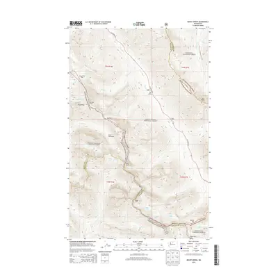
2014 Map of Mount Arriva
USGS Topo · Published 2014About this map
North Cascades National Park and the surrounding wilderness of the Okanogan National Forest converge in this high-altitude landscape. The map centers on the meeting point of Skagit, Okanogan, and Chelan counties, defined by the towering summits of Mt Arriva and Black Peak. Glacial features are prominent, including the Mesahchie Glacier and Lewis Glacier, which feed into complex drainage systems like Fisher Creek Basin and the headwaters of the Methow River. The area serves as a critical junction for high-country travel, with the N Cascades Hwy providing vehicle access to the Easy Pass Trailhead, while the Pacific Crest National Scenic Trail traverses the eastern edge. This survey documents the mid-2010s state of alpine environments, showing the proximity of permanent snowfields and glaciers to named passes like Horsefly Pass and Heather Pass.
Find a feature on this map
44 named features on this map. Tap any name to fly to it.
Don’t see what you’re looking for? This feature index may not catch every label — zoom into the map to look around manually.
Map Details
Editions of this 2014 Mount Arriva Map
This is the sole edition of this map. No revisions or reprints were ever made.
Other maps of this area

1902 · Stehekin
USGS Topo · 1:125,000

1904 · Stehekin
USGS Topo · 1:125,000

1920 · Slate Pass
USGS Topo · 1:125,000

1955 · Concrete
USGS Topo · 1:250,000

1958 · Concrete
USGS Topo · 1:250,000

1962 · Concrete
USGS Topo · 1:250,000

1963 · Washington Pass
USGS Topo · 1:24,000

1963 · Mc Gregor Mtn
USGS Topo · 1:24,000

1963 · Azurite Peak
USGS Topo · 1:24,000

1963 · Slate Peak
USGS Topo · 1:24,000