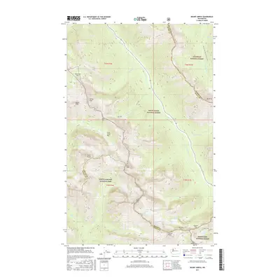
2017 Map of Mount Arriva
USGS Topo · Published 2017About this map
North Cascades National Park and three adjacent national forests converge in this high-altitude landscape, where several county lines meet along jagged divides. The Pacific Crest National Scenic Trail traverses the eastern edge of the quadrangle, passing through the Okanogan National Forest near Mt Hardy. This region is defined by its dramatic vertical relief, featuring prominent summits like Mount Arriva, Black Peak, and Corteo Peak. The hydrology of the area is shaped by perennial snow and ice, most notably the Lewis Glacier, which feeds into Lewis Lake and downstream toward the Mount Baker National Forest. High mountain passes such as Easy Pass, Heather Pass, and Maple Pass provide the only navigable corridors through the steep ridges of Ragged Ridge and the Fisher Creek Basin.
Find a feature on this map
44 named features on this map. Tap any name to fly to it.
Don’t see what you’re looking for? This feature index may not catch every label — zoom into the map to look around manually.
Map Details
Editions of this 2017 Mount Arriva Map
This is the sole edition of this map. No revisions or reprints were ever made.
Other maps of this area

1902 · Stehekin
USGS Topo · 1:125,000

1904 · Stehekin
USGS Topo · 1:125,000

1920 · Slate Pass
USGS Topo · 1:125,000

1955 · Concrete
USGS Topo · 1:250,000

1958 · Concrete
USGS Topo · 1:250,000

1962 · Concrete
USGS Topo · 1:250,000

1963 · Washington Pass
USGS Topo · 1:24,000

1963 · Mc Gregor Mtn
USGS Topo · 1:24,000

1963 · Azurite Peak
USGS Topo · 1:24,000

1963 · Slate Peak
USGS Topo · 1:24,000