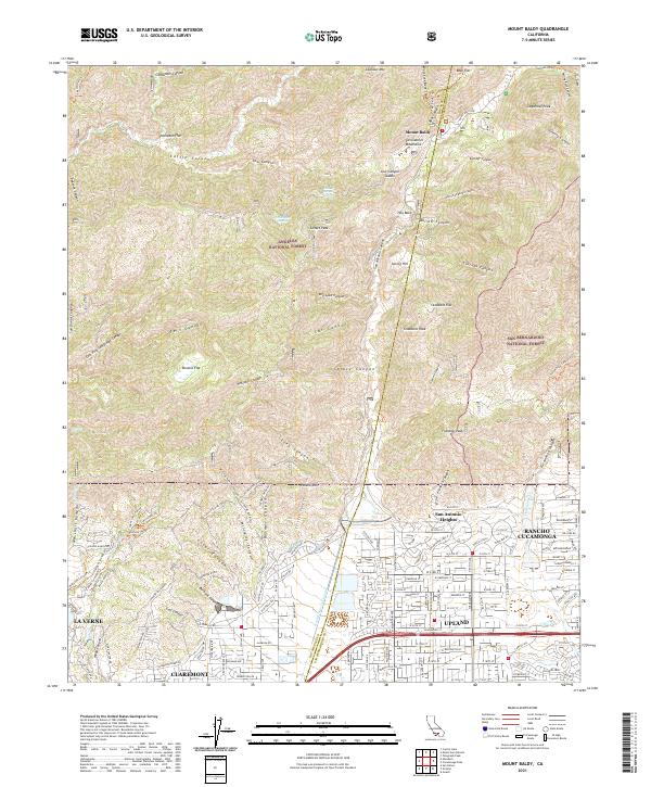
2021 Map of Mount Baldy
USGS Topo · Published 2021About this map
The Angeles National Forest and San Bernardino National Forest meet here along the county line between Los Angeles and San Bernardino counties. This mountain landscape is defined by its dramatic elevation changes, where residential foothills in Upland, Claremont, and Rancho Cucamonga give way to the steep canyons of the San Gabriel Mountains. The map illustrates a network of fire roads and recreational trails, such as the Cobal Cyn Fire Trl and Stephens Ranch Rd, that navigate the terrain surrounding Potato Mtn and Sunset Peak. The transition from suburban development to wildland is stark, with the San Antonio Cr Channel providing a critical drainage link from the high country near Mount Baldy settlement down into the populated San Gabriel Valley. Notable local history landmarks include family-named features like Miller Ranch Rd and old gathering spots like Stoddard Flat.
Find a feature on this map
158 named features on this map. Tap any name to fly to it.
Don’t see what you’re looking for? This feature index may not catch every label — zoom into the map to look around manually.
Map Details
Editions of this 2021 Mount Baldy Map
This is the sole edition of this map. No revisions or reprints were ever made.
Other maps of this area

1894 · Pomona
USGS Topo · 1:62,500

1897 · Pomona
USGS Topo · 1:62,500

1897 · Cucamonga
USGS Topo · 1:62,500

1898 · Pomona
USGS Topo · 1:62,500

1900 · Cucamonga
USGS Topo · 1:62,500

1901 · Southern California Sheet No. 1
USGS Topo · 1:250,000

1903 · Rock Creek
USGS Topo · 1:62,500

1903 · Cucamonga
USGS Topo · 1:62,500

1903 · San Antonio
USGS Topo · 1:62,500

1904 · Pomona
USGS Topo · 1:62,500