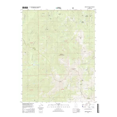
2017 Map of Mount Belknap
USGS Topo · Published 2017About this map
Mount Belknap and Mt Baldy dominate the high-altitude landscape within the Fishlake National Forest during this 2017 survey. The map details the historical mining-related geography of the Tushar Mountains, showing the locations of Upper Kimberly and Lower Kimberly near Suprise Gulch. The transport network is defined by high-elevation routes like the Big John-Marysvale and the Big Meadow-Copper Belt Road, which historically supported the region's mineral extraction. Water resources are marked by the Indian Cr Reservoir and Manderfield Reservoir, while the diverse hydrology includes the headwaters of Fish Creek, Wilson Cr, and the S Fork North Creek. This record preserves the location of Bullion Canyon and its associated Bullion Pasture, key sites in the local mining legacy, alongside distinctive summits like Gold Mtn and Signal Peak.
Find a feature on this map
75 named features on this map. Tap any name to fly to it.
Don’t see what you’re looking for? This feature index may not catch every label — zoom into the map to look around manually.
Map Details
Editions of this 2017 Mount Belknap Map
This is the sole edition of this map. No revisions or reprints were ever made.
Other maps of this area

1885 · Beaver
USGS Topo · 1:250,000

1932 · Sevier
USGS Topo · 1:62,500

1935 · Sevier
USGS Topo · 1:62,500

1937 · Delano Peak
USGS Topo · 1:48,000

1943 · Delano Peak
USGS Topo · 1:62,500

1953 · Richfield
USGS Topo · 1:250,000

1954 · Beaver SE
USGS Topo · 1:24,000

1954 · Beaver NE
USGS Topo · 1:24,000

1958 · Richfield
USGS Topo · 1:250,000

1958 · Beaver
USGS Topo · 1:62,500