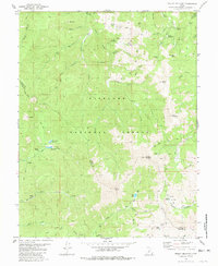
1980 Map of Mount Belknap
USGS Topo · Published 1981About this map
Fish Lake National Forest spans the high peaks of the Tushar Mountains in this 1980 survey, where the border of Piute and Beaver Counties follows the dramatic ridgelines. The map documents a high-altitude mining and water management landscape, featuring the historic mining site at Lower Kimberly and the Grasshopper Mine situated near Upper Kimberly. Significant peaks including Mount Belknap, Mount Baldy, and Gold Mountain dominate the center of the sheet, providing the watershed for critical infrastructure like the Indian Creek Reservoir and Manderfield Reservoir. The presence of several unnamed mines near Bullion Pasture and Bullion Canyon reflects the region's mineral extraction history, while a network of pack and jeep trails suggests a landscape transitioning from heavy industry to mountain recreation by the late twentieth century.
Find a feature on this map
49 named features on this map. Tap any name to fly to it.
Don’t see what you’re looking for? This feature index may not catch every label — zoom into the map to look around manually.
Map Details
Editions of this 1980 Mount Belknap Map
This is the sole edition of this map. No revisions or reprints were ever made.
Other maps of this area

1885 · Beaver
USGS Topo · 1:250,000

1932 · Sevier
USGS Topo · 1:62,500

1935 · Sevier
USGS Topo · 1:62,500

1937 · Delano Peak
USGS Topo · 1:48,000

1943 · Delano Peak
USGS Topo · 1:62,500

1953 · Richfield
USGS Topo · 1:250,000

1954 · Beaver SE
USGS Topo · 1:24,000

1954 · Beaver NE
USGS Topo · 1:24,000

1958 · Richfield
USGS Topo · 1:250,000

1958 · Beaver
USGS Topo · 1:62,500