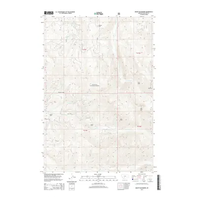
2014 Map of Mount Blackmore
USGS Topo · Published 2014About this map
Mt Blackmore and the high ridges of the Gallatin National Forest dominate this landscape south of Bozeman. The terrain is defined by a dense network of drainages and prominent summits, including Alex Lowe Peak and Kinor Peak. These peaks form the headwaters for numerous creeks like Big Bear Cr and Storm Castle Cr that carve deep into the mountainsides. Historical land use is evidenced by the named ridges and gulches that likely served as early survey markers or points of interest for early visitors and forest rangers. Telephone Ridge and Orchid Gulch provide specific landmarks for those tracing the development of wilderness access. The presence of Big Bear Lake in the northwest quadrant offers a notable high-altitude water feature amidst the complex topography of Timber Butte and Amber Butte.
Find a feature on this map
28 named features on this map. Tap any name to fly to it.
Don’t see what you’re looking for? This feature index may not catch every label — zoom into the map to look around manually.
Map Details
Editions of this 2014 Mount Blackmore Map
This is the sole edition of this map. No revisions or reprints were ever made.
Other maps of this area

1888 · Three Forks
USGS Topo · 1:250,000

1891 · Livingston
USGS Topo · 1:250,000

1893 · Livingston
USGS Topo · 1:250,000

1894 · Three Forks
USGS Topo · 1:250,000

1895 · Three Forks
USGS Topo · 1:250,000

1947 · Bozeman
USGS Topo · 1:250,000

1948 · Bozeman
USGS Topo · 1:250,000

1951 · Bozeman Pass
USGS Topo · 1:62,500

1953 · Bozeman
USGS Topo · 1:62,500

1955 · Bozeman
USGS Topo · 1:250,000