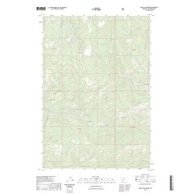
2023 Map of Mount Blackmore
USGS Topo · Published 2023About this map
Gallatin National Forest dominates this high-elevation landscape, where sharp drainage basins and prominent ridgelines define the terrain. The northern reaches are shaped by the flow of Big Bear Creek and the small basin of Big Bear Lake, while to the east, the peaks of Kinor Peak and Mt Blackmore stand as major topographic landmarks. This area is heavily defined by its recreational and forest access network, featuring established paths such as the History Rock Trl and the Storm Castle Ridge Trl.
Find a feature on this map
41 named features on this map. Tap any name to fly to it.
Don’t see what you’re looking for? This feature index may not catch every label — zoom into the map to look around manually.
Map Details
Editions of this 2023 Mount Blackmore Map
This is the sole edition of this map. No revisions or reprints were ever made.
Other maps of this area

1888 · Three Forks
USGS Topo · 1:250,000

1891 · Livingston
USGS Topo · 1:250,000

1893 · Livingston
USGS Topo · 1:250,000

1894 · Three Forks
USGS Topo · 1:250,000

1895 · Three Forks
USGS Topo · 1:250,000

1947 · Bozeman
USGS Topo · 1:250,000

1948 · Bozeman
USGS Topo · 1:250,000

1951 · Bozeman Pass
USGS Topo · 1:62,500

1953 · Bozeman
USGS Topo · 1:62,500

1955 · Bozeman
USGS Topo · 1:250,000