
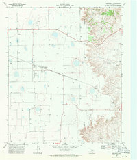
1966 Map of Mount Blanco
USGS Topo · Published 1968About this map
Blanco Canyon dominates this West Texas landscape, cutting a deep incision through the Llano Estacado. The topography reveals the sharp contrast between the flat high plains and the intricate drainage systems of the White River and Crawfish Creek. While much of the surrounding terrain is marked by dozens of small depressions and numerous Well sites, the canyon floor and its rims provide the primary points of interest for historical study.
Find a feature on this map
9 named features on this map. Tap any name to fly to it.
Don’t see what you’re looking for? This feature index may not catch every label — zoom into the map to look around manually.
Map Details
Editions of this 1966 Mount Blanco Map
This is the sole edition of this map. No revisions or reprints were ever made.
Other maps of this area

1954 · Lubbock
USGS Topo · 1:250,000

1965 · Floydada
USGS Topo · 1:24,000

1965 · Floydada SE
USGS Topo · 1:24,000

1965 · Wake
USGS Topo · 1:24,000

1965 · Boothe
USGS Topo · 1:24,000

1966 · Crosbyton
USGS Topo · 1:24,000

1966 · McAdoo
USGS Topo · 1:24,000

1967 · Ralls NE
USGS Topo · 1:24,000
1968 · Dougherty
USGS Topo · 1:24,000
1986 · Lubbock
USGS Topo · 1:100,000