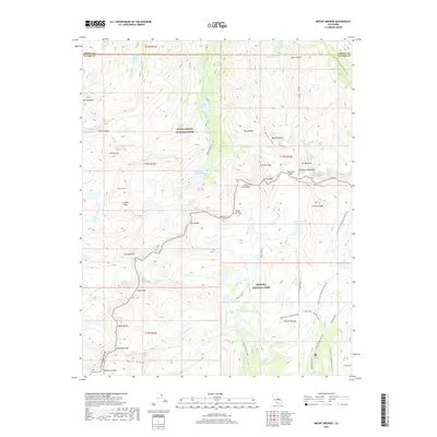
2018 Map of Mount Brewer
USGS Topo · Published 2018About this map
Great Western Divide and the Kings-Kern Divide meet in this high-altitude landscape where the borders of Kings Canyon National Park and Sequoia National Park converge. The terrain is defined by dramatic peaks such as Mt Brewer, Thunder Mtn, and Milestone Mtn, while the headwaters of the Kern River flow south through the Upper Kern Canyon. For backcountry researchers and mountaineers, the map details established routes and stations like the Pacific Crest National Scenic Trail and the Tyndall Ranger Station. This topographic record also preserves the location of many remote alpine water bodies, including Lake Reflection and the geographically named Lake South America, situated beneath Caltech Peak.
Find a feature on this map
59 named features on this map. Tap any name to fly to it.
Don’t see what you’re looking for? This feature index may not catch every label — zoom into the map to look around manually.
Map Details
Editions of this 2018 Mount Brewer Map
This is the sole edition of this map. No revisions or reprints were ever made.
Other maps of this area

1903 · Tehipite
USGS Topo · 1:125,000

1905 · Tehipite
USGS Topo · 1:125,000

1907 · Mt. Whitney
USGS Topo · 1:125,000

1919 · Mt. Whitney
USGS Topo · 1:125,000

1937 · Mt. Whitney
USGS Topo · 1:125,000

1948 · Fresno
USGS Topo · 1:250,000

1953 · Mt. Pinchot
USGS Topo · 1:62,500

1953 · Marion Peak
USGS Topo · 1:62,500

1955 · Fresno
USGS Topo · 1:250,000

1956 · Fresno
USGS Topo · 1:250,000