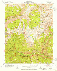
1953 Map of Marion Peak
USGS Topo · Published 1955About this map
Cedar Grove serves as a primary access point along the South Fork Kings River, marking a transition between the deep canyons of the Sierra and the protected wilderness of Kings Canyon National Park. The map documents the high-altitude terrain of the White Divide and the Goddard Creek drainage, where early trans-Sierra travel routes are recorded. Of particular interest to historical researchers is the Kanawyers (Site), representing a former outpost in the heart of the mountains.
Find a feature on this map
115 named features on this map. Tap any name to fly to it.
Don’t see what you’re looking for? This feature index may not catch every label — zoom into the map to look around manually.
Map Details
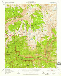
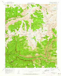
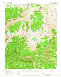
Editions of this 1953 Marion Peak Map
4 editions found
Other maps of this area

1903 · Tehipite
USGS Topo · 1:125,000

1905 · Tehipite
USGS Topo · 1:125,000

1907 · Mt. Whitney
USGS Topo · 1:125,000

1912 · Mt. Goddard
USGS Topo · 1:125,000

1913 · Bishop
USGS Topo · 1:125,000

1919 · Mt. Whitney
USGS Topo · 1:125,000

1937 · Mt. Whitney
USGS Topo · 1:125,000

1947 · Mariposa
USGS Topo · 1:250,000

1948 · Fresno
USGS Topo · 1:250,000

1948 · Mariposa
USGS Topo · 1:250,000