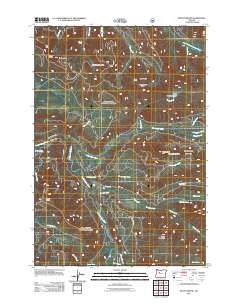
2011 Map of Mount Bruno
USGS Topo · Published 2011About this map
Mount Bruno and the high ridges of the Cascade Range dominate this 2011 topographic study, where the North Santiam River carves through the western slopes of Marion County. This high-elevation landscape is defined by its complex drainage network, where glacier-fed streams like Whitewater Creek, Pamelia Creek, and Grizzly Creek descend from prominent summits such as Outerson Mountain and Minto Mountain. The presence of Triangulation Peak and Spire Rock indicates the sharp, volcanic relief characteristic of the region, while isolated water bodies like Peasley Lake and Jo Jo Lake occupy small basins between the ridges.
Find a feature on this map
38 named features on this map. Tap any name to fly to it.
Don’t see what you’re looking for? This feature index may not catch every label — zoom into the map to look around manually.
Map Details
Editions of this 2011 Mount Bruno Map
This is the sole edition of this map. No revisions or reprints were ever made.
Other maps of this area

1927 · Mt. Jefferson
USGS Topo · 1:125,000

1929 · Mill City
USGS Topo · 1:125,000

1930 · Mt. Jefferson
USGS Topo · 1:125,000

1953 · Salem
USGS Topo · 1:250,000

1954 · Salem
USGS Topo · 1:250,000

1955 · Bend
USGS Topo · 1:250,000

1956 · Battle Ax
USGS Topo · 1:62,500

1956 · Detroit
USGS Topo · 1:62,500

1957 · Bend
USGS Topo · 1:250,000

1958 · Bend
USGS Topo · 1:250,000