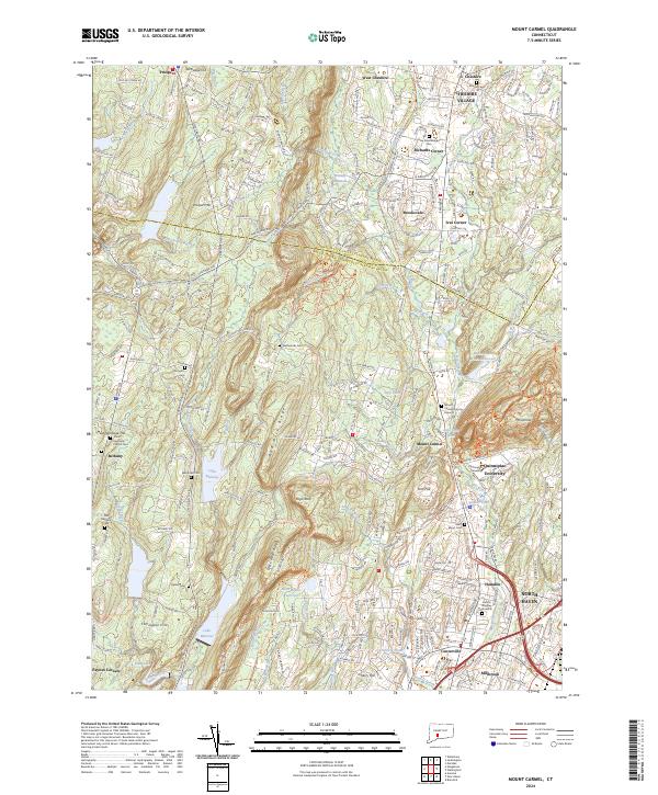
2024 Map of Mount Carmel
USGS Topo · Published 2024About this map
Mount Carmel and the surrounding ridgelines of New Haven County are defined by a complex network of suburban development and protected watersheds. The landscape is anchored by the prominent West Rock Ridge and Mt Carmel, with the Mill River corridor serving as a central artery through Hamden and Cheshire. This modern survey illustrates the dense concentration of historical burial sites and educational institutions that have grown alongside the region's reservoirs, such as Lake Bethany and Lake Watrous.
Find a feature on this map
135 named features on this map. Tap any name to fly to it.
Don’t see what you’re looking for? This feature index may not catch every label — zoom into the map to look around manually.
Map Details
Editions of this 2024 Mount Carmel Map
This is the sole edition of this map. No revisions or reprints were ever made.
Other maps of this area

1889 · Derby
USGS Topo · 1:62,500

1891 · Derby
USGS Topo · 1:62,500

1892 · New Haven
USGS Topo · 1:62,500

1892 · Meriden
USGS Topo · 1:62,500

1893 · Waterbury
USGS Topo · 1:62,500

1893 · Meriden
USGS Topo · 1:62,500

1893 · Derby
USGS Topo · 1:62,500

1904 · Waterbury
USGS Topo · 1:62,500

1904 · Litchfield
USGS Topo · 1:125,000

1906 · Farmington
USGS Topo · 1:125,000