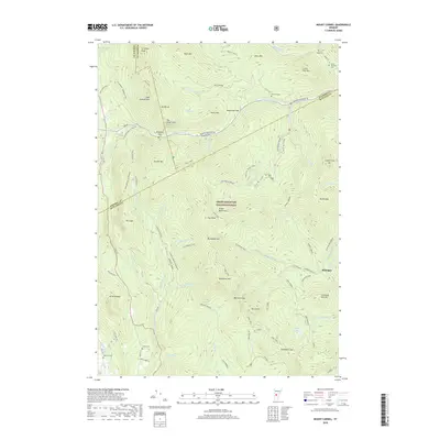
2018 Map of Mount Carmel
USGS Topo · Published 2018About this map
Green Mountain National Forest dominates this Vermont landscape, defined by the spine of the Green Mountains and the winding path of the Long Trail. The terrain is punctuated by high peaks such as Mount Carmel and Bloodroot Mountain, with deep passages like Brandon Gap and Bloodroot Gap providing historical transit routes through the high country. For genealogists and local historians, the presence of family-named burial grounds like Oliver Reynolds Cemetery and West Hill Cemetery offers a connection to the area's early families. The small settlement at Michigan sits along the Michigan Brook, while several cross-country ski trails and forest roads like Puss and Kill and Lost Horizon snake through the drainage basins of Chittenden Brook and Furnace Brook. The map reveals a mountain economy transitioning from early industry, evidenced by Kiln Brook, to modern conservation and recreation.
Find a feature on this map
91 named features on this map. Tap any name to fly to it.
Don’t see what you’re looking for? This feature index may not catch every label — zoom into the map to look around manually.
Map Details
Editions of this 2018 Mount Carmel Map
This is the sole edition of this map. No revisions or reprints were ever made.
Other maps of this area

1891 · Rutland
USGS Topo · 1:62,500

1893 · Rutland
USGS Topo · 1:62,500

1895 · Castleton
USGS Topo · 1:62,500

1897 · Castleton
USGS Topo · 1:62,500

1902 · Brandon
USGS Topo · 1:62,500

1904 · Brandon
USGS Topo · 1:62,500

1915 · Rochester
USGS Topo · 1:62,500

1917 · Rochester
USGS Topo · 1:62,500

1920 · Brandon
USGS Topo · 1:62,500

1944 · Proctor
USGS Topo · 1:31,680