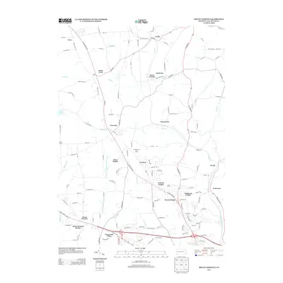
2013 Map of Mount Chestnut
USGS Topo · Published 2013About this map
Mount Chestnut and the surrounding Butler County landscape are defined by a network of residential clusters and recreational spaces. In the early 21st century, the area shows a distinct pattern of modern suburban expansion with named developments like Timberly Heights, Windward Heights, and Shanor Heights established along the ridges and arterial roads. The terrain is deeply carved by waterways, with the Little Connoquenessing Cr and Crooked Run winding toward the southern border. This period of the landscape's history is marked by the presence of institutional and recreational anchors, including Camp Wesley, Camp Alameda, and the Aubreys Golf Course. To the north, the junction at Queen Junction and the settlement of Euclid hint at the area's older transit corridors, while the eastern edge of Lake Arthur touches the western boundary, signifying the importance of regional water management and recreation.
Find a feature on this map
133 named features on this map. Tap any name to fly to it.
Don’t see what you’re looking for? This feature index may not catch every label — zoom into the map to look around manually.
Map Details
Editions of this 2013 Mount Chestnut Map
This is the sole edition of this map. No revisions or reprints were ever made.
Other maps of this area

1908 · Zelienople
USGS Topo · 1:62,500

1909 · Butler
USGS Topo · 1:62,500

1910 · Zelienople
USGS Topo · 1:62,500

1910 · Hilliards
USGS Topo · 1:62,500

1911 · Butler
USGS Topo · 1:62,500

1912 · Hilliards
USGS Topo · 1:62,500

1913 · Mercer
USGS Topo · 1:62,500

1939 · Mercer
USGS Topo · 1:62,500

1943 · Mercer
USGS Topo · 1:62,500

1944 · Hilliards
USGS Topo · 1:62,500