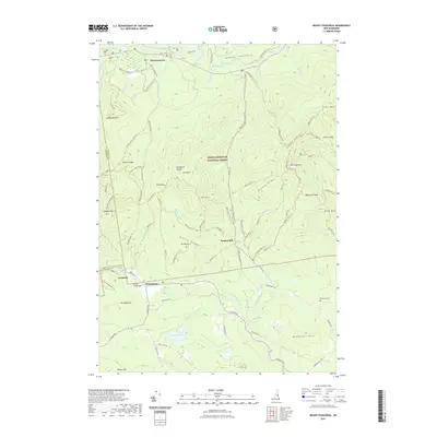
2021 Map of Mount Chocorua
USGS Topo · Published 2021About this map
Passaconaway and the Albany Intervale anchor the northern reaches of this landscape, situated along the winding Swift River. This region within the White Mountain National Forest is defined by the high peaks of the Sandwich Range, including Mt Paugus and the distinctive Mt Chocorua. A complex network of historic paths and timber-era routes, such as the Bolles Trl and Oliverian Brook Xc Trl, crisscrosses the terrain, connecting high points like Whitin Ridge to former industrial sites like Paugus Mill. To the south, the settlements of Wonalancet, Ferncroft, and Birch Intervale sit along the Wonalancet River, offering a view of early mountain agriculture and community life. The presence of the Albany Cem and Effingham Cem provides genealogical touchpoints for families rooted in these granite-strewn valleys.
Find a feature on this map
97 named features on this map. Tap any name to fly to it.
Don’t see what you’re looking for? This feature index may not catch every label — zoom into the map to look around manually.
Map Details
Editions of this 2021 Mount Chocorua Map
This is the sole edition of this map. No revisions or reprints were ever made.
Other maps of this area

1894 · North Conway
USGS Topo · 1:62,500

1895 · Crawford Notch
USGS Topo · 1:62,500

1896 · Crawford Notch
USGS Topo · 1:62,500

1896 · North Conway
USGS Topo · 1:62,500

1930 · Ossipee Lake
USGS Topo · 1:62,500

1931 · Mt. Chocorua
USGS Topo · 1:62,500

1942 · North Conway
USGS Topo · 1:62,500

1945 · North Conway
USGS Topo · 1:62,500

1946 · Crawford Notch
USGS Topo · 1:62,500

1949 · Portland
USGS Topo · 1:250,000