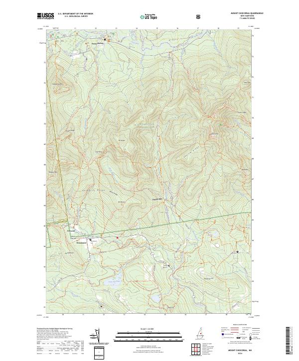
2024 Map of Mount Chocorua
USGS Topo · Published 2024About this map
The White Mountain National Forest dominates this topographic view, revealing the intricate trail network and high-elevation terrain of the Sandwich Range Wilderness. At the northern edge, the settlement of Passaconaway sits along the Swift River near the Colbath Cem, while the southern reaches feature the smaller communities of Ferncroft and Wonalancet. This landscape is defined by its dramatic peaks, including the iconic Mt Chocorua and its radiating ridges like Three Sisters and Farlow Ridge. The map documents a complex system of historical routes, from the Old Mast Road Trl to the Chinook Trl, illustrating the evolution of forest access. Notable water features like Great Hill Pond and the Chocorua River drain the slopes, while legacy sites like Paugus Mill and various family cemeteries, such as the Effingham Cem and Pease Cem, anchor the human history of this mountain region.
Find a feature on this map
88 named features on this map. Tap any name to fly to it.
Don’t see what you’re looking for? This feature index may not catch every label — zoom into the map to look around manually.
Map Details
Editions of this 2024 Mount Chocorua Map
This is the sole edition of this map. No revisions or reprints were ever made.
Other maps of this area

1894 · North Conway
USGS Topo · 1:62,500

1895 · Crawford Notch
USGS Topo · 1:62,500

1896 · Crawford Notch
USGS Topo · 1:62,500

1896 · North Conway
USGS Topo · 1:62,500

1930 · Ossipee Lake
USGS Topo · 1:62,500

1931 · Mt. Chocorua
USGS Topo · 1:62,500

1942 · North Conway
USGS Topo · 1:62,500

1945 · North Conway
USGS Topo · 1:62,500

1946 · Crawford Notch
USGS Topo · 1:62,500

1949 · Portland
USGS Topo · 1:250,000