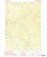
1987 Map of Mount Chocorua
USGS Topo · Published 1987About this map
Passaconaway and Wonalancet anchor this 1980s-era map of the Sandwich Range, where the settlement patterns reflect a legacy of logging and mountain tourism. The landscape is defined by the White Mountain National Forest and the Sandwich Wilderness Area, crisscrossed by an extensive network of footpaths including the Piper Trail, Bolles Trail, and the aptly named Old Mast Road. A concentration of seasonal and remote landmarks such as Old Stag Camp, the Carrigain Outlook, and the Lookout Tower on Great Hill suggest a region heavily oriented toward conservation and recreation.
Find a feature on this map
67 named features on this map. Tap any name to fly to it.
Don’t see what you’re looking for? This feature index may not catch every label — zoom into the map to look around manually.
Map Details
Editions of this 1987 Mount Chocorua Map
This is the sole edition of this map. No revisions or reprints were ever made.
Other maps of this area

1894 · North Conway
USGS Topo · 1:62,500

1895 · Crawford Notch
USGS Topo · 1:62,500

1896 · Crawford Notch
USGS Topo · 1:62,500

1896 · North Conway
USGS Topo · 1:62,500

1930 · Ossipee Lake
USGS Topo · 1:62,500

1931 · Mt. Chocorua
USGS Topo · 1:62,500

1942 · North Conway
USGS Topo · 1:62,500

1945 · North Conway
USGS Topo · 1:62,500

1946 · Crawford Notch
USGS Topo · 1:62,500

1949 · Portland
USGS Topo · 1:250,000