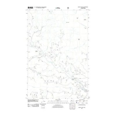
2011 Map of Mount Clifty
USGS Topo · Published 2011About this map
Little Naches River defines the drainage patterns of this mountain landscape, joined by numerous tributaries including Crow Creek, Jungle Creek, and Pileup Creek. The terrain is characterized by high ridges and distinct peaks such as Mount Clifty and Lookout Mountain, connected by high-altitude passages like Windy Pass. Several meadows are scattered throughout the forest, notably Mathew Meadow, Lost Meadow, and Longmire Meadows, which suggest a history of seasonal grazing or natural clearings in the heavy timber.
Find a feature on this map
29 named features on this map. Tap any name to fly to it.
Don’t see what you’re looking for? This feature index may not catch every label — zoom into the map to look around manually.
Map Details
Editions of this 2011 Mount Clifty Map
This is the sole edition of this map. No revisions or reprints were ever made.
Other maps of this area

1901 · Snoqualmie Pass
USGS Topo · 1:125,000

1902 · Mount Aix
USGS Topo · 1:125,000

1903 · Snoqualmie
USGS Topo · 1:125,000

1904 · Mt Aix
USGS Topo · 1:125,000

1950 · Yakima
USGS Topo · 1:250,000

1957 · Wenatchee
USGS Topo · 1:250,000

1958 · Yakima
USGS Topo · 1:250,000

1961 · Yakima
USGS Topo · 1:250,000

1961 · Easton
USGS Topo · 1:62,500

1962 · Bumping Lake
USGS Topo · 1:62,500