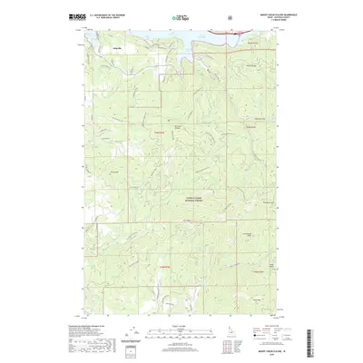
2020 Map of Mount Coeur D'Alene
USGS Topo · Published 2020About this map
Eddyville sits along the northeastern shores of Coeur d'Alene Lake, serving as a gateway to the high ridgelines of the Coeur d'Alene National Forest. The complex shoreline is defined by numerous inlets, including Neachen Bay, Moscow Bay, and the prominent Beauty Bay, where the landscape rises sharply toward Mineral Ridge. This terrain is characterized by a series of high summits such as Mt Coeur d'Alene and Carlin Peak, which divide the drainages of Beauty Cr and Carlin Cr.
Find a feature on this map
75 named features on this map. Tap any name to fly to it.
Don’t see what you’re looking for? This feature index may not catch every label — zoom into the map to look around manually.
Map Details
Editions of this 2020 Mount Coeur D'Alene Map
This is the sole edition of this map. No revisions or reprints were ever made.
Other maps of this area

1903 · Rathdrum
USGS Topo · 1:125,000

1955 · Spokane
USGS Topo · 1:250,000

1957 · St. Maries
USGS Topo · 1:62,500

1957 · Plummer
USGS Topo · 1:62,500

1957 · Coeur D'Alene
USGS Topo · 1:62,500

1957 · Lane
USGS Topo · 1:62,500

1958 · Spokane
USGS Topo · 1:250,000

1975 · Coeur D'Alene SE
USGS Topo · 1:24,000

1975 · Plummer NE
USGS Topo · 1:24,000
1975 · Lane SW
USGS Topo · 1:24,000