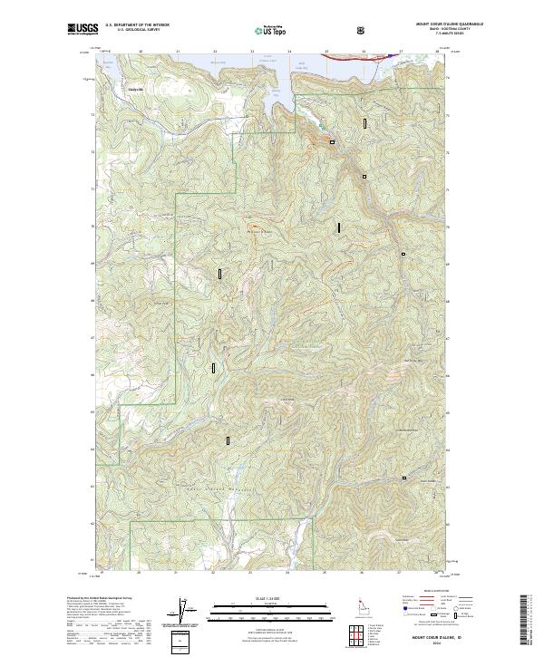
2024 Map of Mount Coeur D'Alene
USGS Topo · Published 2024About this map
Coeur d'Alene National Forest blankets this corner of the Idaho Panhandle, where the high peaks of the Coeur d'Alene Mountains descend into the eastern reaches of Coeur d'Alene Lake. The map details a landscape of timber and recreation, centered on Mt Coeur d'Alene and the prominent Caribou Ridge. Along the northern shoreline, deep inlets like Wolf Lodge Bay, Beauty Bay, and Moscow Bay provided historic access points for lake traffic and later development at Eddyville. The steep elevation changes are navigated by a network of forest roads and the Canyon Creek National Recreation Trail. These highlands are drained by numerous waterways, including Steamboat Creek and Carlin Creek, which have carved the terrain into distinct features such as Mineral Ridge and Murphy Draw.
Find a feature on this map
70 named features on this map. Tap any name to fly to it.
Don’t see what you’re looking for? This feature index may not catch every label — zoom into the map to look around manually.
Map Details
Editions of this 2024 Mount Coeur D'Alene Map
This is the sole edition of this map. No revisions or reprints were ever made.
Other maps of this area

1903 · Rathdrum
USGS Topo · 1:125,000

1955 · Spokane
USGS Topo · 1:250,000

1957 · St. Maries
USGS Topo · 1:62,500

1957 · Plummer
USGS Topo · 1:62,500

1957 · Coeur D'Alene
USGS Topo · 1:62,500

1957 · Lane
USGS Topo · 1:62,500

1958 · Spokane
USGS Topo · 1:250,000

1975 · Coeur D'Alene SE
USGS Topo · 1:24,000

1975 · Plummer NE
USGS Topo · 1:24,000
1975 · Lane SW
USGS Topo · 1:24,000