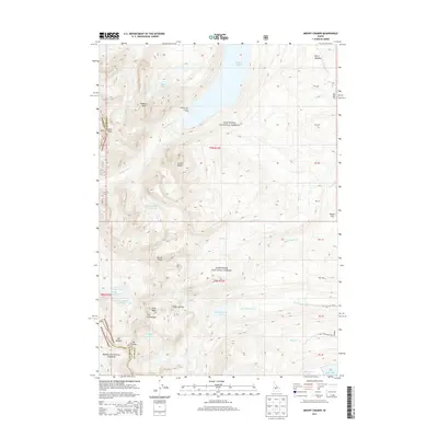
2013 Map of Mount Cramer
USGS Topo · Published 2013About this map
Mt Cramer stands as the central topographic focal point in this high-altitude landscape within the Sawtooth National Forest. The 2013 survey illustrates a complex glacial geography where numerous alpine basins are now occupied by distinctive water bodies such as Hell Roaring Lake, Imogene Lake, and the tiered sequence of Lower Cramer Lake, Middle Cramer Lake, and Upper Cramer Lake. This area, straddling the Boise and Custer County line, is defined by its dramatic vertical relief, featuring granite spires with evocative names like the Finger of Fate, The Temple, and The Arrowhead. At the northern edge, the southern tip of Redfish Lake is visible, including the Redfish Inlet Transfer Camp, which serves as a vital transition point for travelers moving between the water and the backcountry trails that navigate the steep slopes of Heyburn Mtn and the Grand Mogul.
Find a feature on this map
46 named features on this map. Tap any name to fly to it.
Don’t see what you’re looking for? This feature index may not catch every label — zoom into the map to look around manually.
Map Details
Editions of this 2013 Mount Cramer Map
This is the sole edition of this map. No revisions or reprints were ever made.
Other maps of this area

1891 · Bear Valley
USGS Topo · 1:125,000

1893 · Bear Valley
USGS Topo · 1:125,000

1894 · Rocky Bar
USGS Topo · 1:125,000

1900 · Sawtooth
USGS Topo · 1:125,000

1919 · Custer
USGS Topo · 1:125,000

1922 · Custer
USGS Topo · 1:125,000

1955 · Hailey
USGS Topo · 1:250,000

1957 · Challis
USGS Topo · 1:250,000

1959 · Hailey
USGS Topo · 1:250,000

1960 · Challis
USGS Topo · 1:250,000