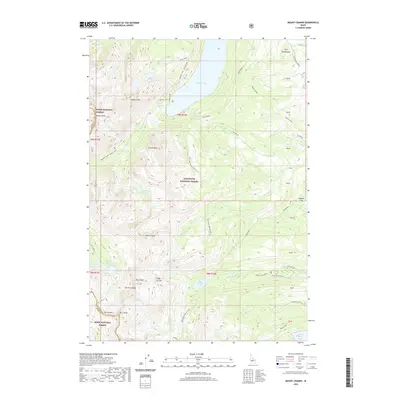
2020 Map of Mount Cramer
USGS Topo · Published 2020About this map
Redfish Lake anchors the northern extent of this high-altitude landscape where the Boise National Forest and Sawtooth National Forest converge. The topography is defined by dramatic granite peaks and deep glacial basins, including the spire-like Finger of Fate and the massive bulk of Mt Cramer along the border of Boise and Custer Counties. A complex hydrological network connects remote alpine waters like the Upper Cramer Lake series and Hell Roaring Lake via steep drainage systems like Redfish Creek - Baron Creek. This era of the backcountry is characterized by primitive access, with the 210 Road (Snow) and forest roads such as Nat For Dev RD 315 providing the only vehicular routes into the high meadows and lake inlets, preserved for wilderness and watershed protection.
Find a feature on this map
55 named features on this map. Tap any name to fly to it.
Don’t see what you’re looking for? This feature index may not catch every label — zoom into the map to look around manually.
Map Details
Editions of this 2020 Mount Cramer Map
This is the sole edition of this map. No revisions or reprints were ever made.
Other maps of this area

1891 · Bear Valley
USGS Topo · 1:125,000

1893 · Bear Valley
USGS Topo · 1:125,000

1894 · Rocky Bar
USGS Topo · 1:125,000

1900 · Sawtooth
USGS Topo · 1:125,000

1919 · Custer
USGS Topo · 1:125,000

1922 · Custer
USGS Topo · 1:125,000

1955 · Hailey
USGS Topo · 1:250,000

1957 · Challis
USGS Topo · 1:250,000

1959 · Hailey
USGS Topo · 1:250,000

1960 · Challis
USGS Topo · 1:250,000