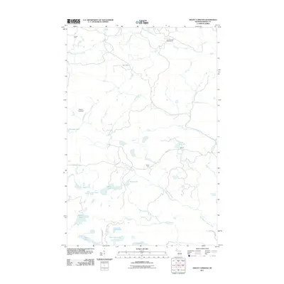
2011 Map of Mount Curwood
USGS Topo · Published 2011About this map
Mount Curwood rises as a prominent landmark in the north woods of Baraga County, marking the high ground between several major Upper Peninsula watersheds. In the early 21st century, this remote area remains defined by its network of rivers and seasonal encampments, including Elmblad Camp, Ruona Camp, and Sensenbrenner-Seldon Camp. The Slate River and East Branch Silver River drain the northern slopes, while the Peshekee River and its western branch dominate the southern half of the landscape. Significant portions of the southern terrain are preserved within Craig Lake State Park, which encompasses a chain of water bodies including Loon Lake, Jims Lake, and High Life Lake. The presence of established outposts like Snyder Camp and Camp 10 along Celotex Rd illustrates the area's continued use for timber management and outdoor recreation.
Find a feature on this map
25 named features on this map. Tap any name to fly to it.
Don’t see what you’re looking for? This feature index may not catch every label — zoom into the map to look around manually.
Map Details
Editions of this 2011 Mount Curwood Map
This is the sole edition of this map. No revisions or reprints were ever made.
Other maps of this area

1954 · Skanee
USGS Topo · 1:62,500

1954 · Keweenaw Bay
USGS Topo · 1:62,500

1955 · Herman
USGS Topo · 1:62,500

1956 · Three Lakes
USGS Topo · 1:24,000

1956 · Michigamme
USGS Topo · 1:62,500

1956 · Michigamme
USGS Topo · 1:24,000

1958 · Iron River
USGS Topo · 1:250,000

1960 · Iron River
USGS Topo · 1:250,000

1961 · Iron River
USGS Topo · 1:250,000

1967 · Iron River
USGS Topo · 1:250,000