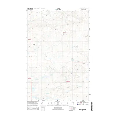
2014 Map of Mount Curwood
USGS Topo · Published 2014About this map
Mt Curwood stands as the central landmark of this Michigan backcountry, anchoring a network of high ridges and watercourses in Baraga County. The landscape is defined by the headwaters of the Peshekee River and its major tributaries, including the W Br Peshekee River, which flow through a region dense with remote lakes. Small water bodies like High Life Lake, Dirkman Lake, and Camp Ten Lake are scattered throughout the township lines, often accessed only by forest routes such as Burma Rd or Ruona Hill Rd. This survey illustrates a timber-rich interior where industrial access roads like Celotex Rd and Huron Bay-Peshekee Rd intersect the natural drainage basins of the Slate River and E Br Silver River.
Find a feature on this map
26 named features on this map. Tap any name to fly to it.
Don’t see what you’re looking for? This feature index may not catch every label — zoom into the map to look around manually.
Map Details
Editions of this 2014 Mount Curwood Map
This is the sole edition of this map. No revisions or reprints were ever made.
Other maps of this area

1954 · Skanee
USGS Topo · 1:62,500

1954 · Keweenaw Bay
USGS Topo · 1:62,500

1955 · Herman
USGS Topo · 1:62,500

1956 · Three Lakes
USGS Topo · 1:24,000

1956 · Michigamme
USGS Topo · 1:62,500

1956 · Michigamme
USGS Topo · 1:24,000

1958 · Iron River
USGS Topo · 1:250,000

1960 · Iron River
USGS Topo · 1:250,000

1961 · Iron River
USGS Topo · 1:250,000

1967 · Iron River
USGS Topo · 1:250,000