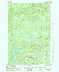
1985 Map of Mount Curwood
USGS Topo · Published 1985About this map
Mount Curwood rises as the central topographical landmark in this interior portion of Baraga County, situated within the expansive Copper Country State Forest. The area is defined by a dense network of high-altitude glacial lakes and winding waterways, including the headwaters of the Peshekee River and the West Branch Peshekee River. The southern portion of the sheet transitions into Craig Lake State Park, where secluded water bodies like Clair Lake and Jims Lake dominate the landscape. Evidence of industrial activity is sparse but present, marked by a Gravel Pit near the riverbanks. The survey captures the remote character of the Upper Peninsula just as modern conservation boundaries were being formalized, preserving a landscape of named points like Dirkman Lake and High Life Lake that remain significant to local outdoorsmen and conservationists.
Find a feature on this map
23 named features on this map. Tap any name to fly to it.
Don’t see what you’re looking for? This feature index may not catch every label — zoom into the map to look around manually.
Map Details
Editions of this 1985 Mount Curwood Map
This is the sole edition of this map. No revisions or reprints were ever made.
Other maps of this area

1954 · Skanee
USGS Topo · 1:62,500

1954 · Keweenaw Bay
USGS Topo · 1:62,500

1955 · Herman
USGS Topo · 1:62,500

1956 · Three Lakes
USGS Topo · 1:24,000

1956 · Michigamme
USGS Topo · 1:62,500

1956 · Michigamme
USGS Topo · 1:24,000

1958 · Iron River
USGS Topo · 1:250,000

1960 · Iron River
USGS Topo · 1:250,000

1961 · Iron River
USGS Topo · 1:250,000

1967 · Iron River
USGS Topo · 1:250,000