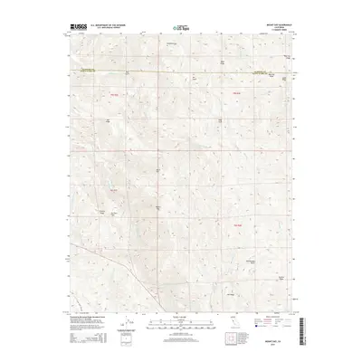
2015 Map of Mount Day
USGS Topo · Published 2015About this map
Mount Day and the surrounding peaks of the Diablo Range dominate this 2015 survey of the borderlands between Alameda and Santa Clara counties. The landscape is characterized by a complex network of high ridges, including Beartrap Ridge, Valpe Ridge, and Oak Ridge, which partition the drainage basins of Alameda Cr and Arroyo Hondo. Small, high-altitude pockets of level ground such as Hamilton Flat and Van Horn Flats suggest historical points of human activity or grazing in an otherwise steep environment. The map details the transition from the watershed of Calaveras Cr toward the summit of Mt Lewis, illustrating how the terrain was divided by the Public Land Survey System. Modern infrastructure is sparse, limited primarily to Alum Rock Falls Rd and primitive tracks connecting the various peaks and remote flats.
Find a feature on this map
32 named features on this map. Tap any name to fly to it.
Don’t see what you’re looking for? This feature index may not catch every label — zoom into the map to look around manually.
Map Details
Editions of this 2015 Mount Day Map
This is the sole edition of this map. No revisions or reprints were ever made.
Other maps of this area

1889 · San Jose
USGS Topo · 1:62,500

1897 · San Jose
USGS Topo · 1:62,500

1897 · Mt. Hamilton
USGS Topo · 1:62,500

1899 · San Jose
USGS Topo · 1:62,500

1906 · Pleasanton
USGS Topo · 1:62,500

1907 · Tesla
USGS Topo · 1:62,500

1941 · Pleasanton
USGS Topo · 1:62,500

1942 · Mt. Hamilton
USGS Topo · 1:62,500

1942 · Altamont
USGS Topo · 1:62,500

1943 · Pleasanton
USGS Topo · 1:62,500