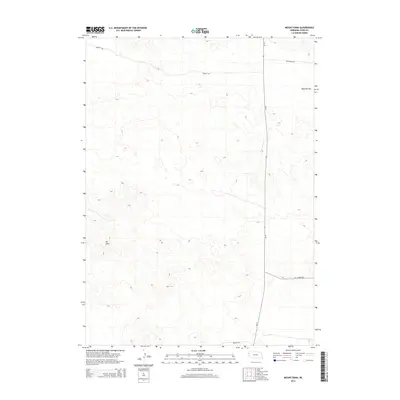
2014 Map of Mount Edna
USGS Topo · Published 2014About this map
Mt Edna stands as the primary landmark in this section of Sioux County, overlooking a landscape defined by expansive high-plains terrain. This 2014 survey captures a sparsely populated region of northwestern Nebraska where land use is dominated by large-scale ranching and agriculture, as evidenced by the broad expanse of Royville Flat in the northeast. The transport network is anchored by Ne-29, which runs north-south through the eastern half of the quadrangle, serving as the main artery for the area.
Find a feature on this map
7 named features on this map. Tap any name to fly to it.
Don’t see what you’re looking for? This feature index may not catch every label — zoom into the map to look around manually.
Map Details
Editions of this 2014 Mount Edna Map
This is the sole edition of this map. No revisions or reprints were ever made.
Other maps of this area

1899 · Whistle Creek
USGS Topo · 1:125,000

1955 · Alliance
USGS Topo · 1:250,000

1957 · Alliance
USGS Topo · 1:250,000

1958 · Alliance
USGS Topo · 1:250,000

1963 · Chalk Buttes
USGS Topo · 1:24,000

1979 · Mount Edna
USGS Topo · 1:24,000
1979 · Agate SW
USGS Topo · 1:24,000
1979 · Agate NW
USGS Topo · 1:24,000

1979 · Agate
USGS Topo · 1:24,000
1983 · Chalk Buttes NE
USGS Topo · 1:24,000