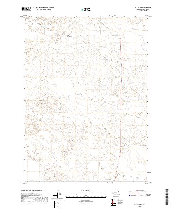
2021 Map of Mount Edna
USGS Topo · Published 2021About this map
Mt Edna serves as the namesake landmark for this portion of Sioux County, defined by a sparse network of ranch roads and high plains terrain. The landscape is characterized by its isolation, with Rayville Flat occupying the northeastern corner and a handful of dirt routes providing the only access through the rolling topography. The survey shows a region almost entirely dedicated to rangeland, where the primary infrastructure consists of long-established thoroughfares such as Murphy Rd, White Rock Rd, and Cut Across Rd. This modern topographical study reveals the enduring section lines of the Public Land Survey System, illustrating how historical property divisions continue to shape the movement and land use of this rural Nebraska environment.
Find a feature on this map
11 named features on this map. Tap any name to fly to it.
Don’t see what you’re looking for? This feature index may not catch every label — zoom into the map to look around manually.
Map Details
Editions of this 2021 Mount Edna Map
This is the sole edition of this map. No revisions or reprints were ever made.
Other maps of this area

1899 · Whistle Creek
USGS Topo · 1:125,000

1955 · Alliance
USGS Topo · 1:250,000

1957 · Alliance
USGS Topo · 1:250,000

1958 · Alliance
USGS Topo · 1:250,000

1963 · Chalk Buttes
USGS Topo · 1:24,000

1979 · Mount Edna
USGS Topo · 1:24,000
1979 · Agate SW
USGS Topo · 1:24,000
1979 · Agate NW
USGS Topo · 1:24,000

1979 · Agate
USGS Topo · 1:24,000
1983 · Chalk Buttes NE
USGS Topo · 1:24,000