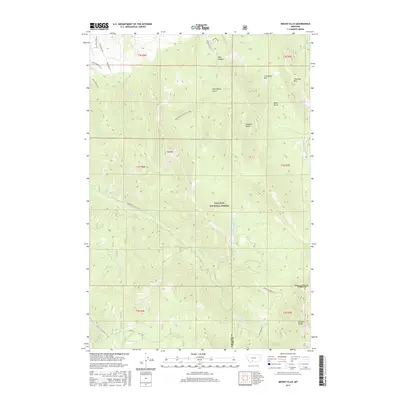
2017 Map of Mount Ellis
USGS Topo · Published 2017About this map
Gallatin National Forest dominates this landscape southeast of Bozeman, where the high peaks of the Gallatin Range meet deep drainages and canyon roads. The terrain is defined by prominent summits like Mt Ellis and Chestnut Mtn, which frame a network of creeks including Bozeman Cr and Hyalite Cr. This modern survey details the interface between growing residential developments on the northwestern edge, marked by Triple Tree Ln, and the protected wilderness areas to the south and east. A significant portion of the map covers the watershed surrounding Mystic Lake, accessible via the Bozeman Creek Rd and Sourdough Canyon Rd. For those tracing recreational or land-use history, the map provides exact alignments for the Triple Tree Trail and the Moonshine Gulch Trail #438, illustrating how local paths weave through features like New World Gulch and Bear Canyon.
Find a feature on this map
41 named features on this map. Tap any name to fly to it.
Don’t see what you’re looking for? This feature index may not catch every label — zoom into the map to look around manually.
Map Details
Editions of this 2017 Mount Ellis Map
This is the sole edition of this map. No revisions or reprints were ever made.
Other maps of this area

1888 · Three Forks
USGS Topo · 1:250,000

1891 · Livingston
USGS Topo · 1:250,000

1893 · Livingston
USGS Topo · 1:250,000

1894 · Three Forks
USGS Topo · 1:250,000

1895 · Three Forks
USGS Topo · 1:250,000

1947 · Bozeman
USGS Topo · 1:250,000

1948 · Bozeman
USGS Topo · 1:250,000

1951 · Bozeman Pass
USGS Topo · 1:62,500

1953 · Bozeman
USGS Topo · 1:62,500

1955 · Bozeman
USGS Topo · 1:250,000