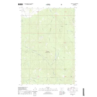
2020 Map of Mount Ellis
USGS Topo · Published 2020About this map
Gallatin National Forest dominates this section of the Gallatin Range, where the landscape is defined by deep drainages and high peaks. The terrain rises sharply to summits like Mt Ellis and Francham Mtn, while the hydrology of the area is anchored by Mystic Lake and the various branches of Bozeman Creek. The map reveals a complex network of backcountry routes, including the Triple Tree Trail and the Mystic Lake Cutoff, which facilitate movement through the steep elevation changes. Of particular interest to local historians and naturalists are the named mineral licks, such as Moser Lick, Upper Wildhorse Lick, and Lower Wildhorse Lick, which suggest long-standing patterns of wildlife activity and perhaps early hunting or surveying landmarks. The presence of Chestnut Mtn and various gulches like New World Gulch indicates a landscape heavily influenced by both its geological formation and its later naming by those who worked or explored these canyons.
Find a feature on this map
47 named features on this map. Tap any name to fly to it.
Don’t see what you’re looking for? This feature index may not catch every label — zoom into the map to look around manually.
Map Details
Editions of this 2020 Mount Ellis Map
This is the sole edition of this map. No revisions or reprints were ever made.
Other maps of this area

1888 · Three Forks
USGS Topo · 1:250,000

1891 · Livingston
USGS Topo · 1:250,000

1893 · Livingston
USGS Topo · 1:250,000

1894 · Three Forks
USGS Topo · 1:250,000

1895 · Three Forks
USGS Topo · 1:250,000

1947 · Bozeman
USGS Topo · 1:250,000

1948 · Bozeman
USGS Topo · 1:250,000

1951 · Bozeman Pass
USGS Topo · 1:62,500

1953 · Bozeman
USGS Topo · 1:62,500

1955 · Bozeman
USGS Topo · 1:250,000