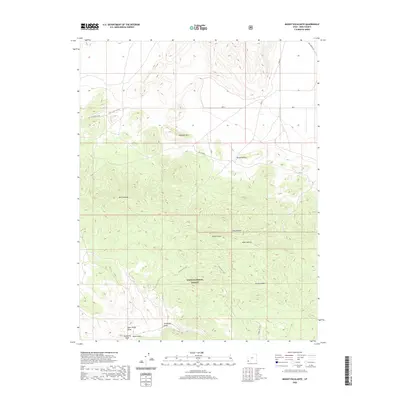
2020 Map of Mount Escalante
USGS Topo · Published 2020About this map
Dixie National Forest dominates the southern landscape of this Iron County quadrangle, where the high-altitude terrain rises to the summit of Mt Escalante. The area is characterized by a complex network of canyons and draws, including Horse Canyon and the notable Indian Draw, which cut through the uplifted plateaus. Transport across this high desert environment is marked by historical routes like the Old Modena Rd and specialized paths such as the S Devils Gap Cutoff.
Find a feature on this map
17 named features on this map. Tap any name to fly to it.
Don’t see what you’re looking for? This feature index may not catch every label — zoom into the map to look around manually.
Map Details
Editions of this 2020 Mount Escalante Map
This is the sole edition of this map. No revisions or reprints were ever made.
Other maps of this area

1885 · St. George
USGS Topo · 1:250,000

1885 · Pioche
USGS Topo · 1:250,000

1886 · Pioche
USGS Topo · 1:250,000

1891 · St. George
USGS Topo · 1:250,000

1953 · Cedar City
USGS Topo · 1:250,000

1954 · Caliente
USGS Topo · 1:250,000

1958 · Cedar City
USGS Topo · 1:250,000

1959 · Caliente
USGS Topo · 1:250,000

1962 · Cedar City
USGS Topo · 1:250,000
1972 · Uvada
USGS Topo · 1:24,000