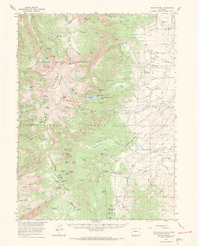
1955 Map of Mount Ethel
USGS Topo · Published 1969About this map
High mountain peaks and intricate irrigation networks define this portion of the Continental Divide within the Routt National Forest. The landscape is dominated by the rocky summits of Mount Zirkel and Mount Ethel, surrounded by a dense cluster of alpine basins such as Ptarmigan Lake and Upper Slide Lake. This mid-century survey reveals a distinct geographic divide between the wilderness of the Zirkel Wilderness and the active ranching operations to the east.
Find a feature on this map
129 named features on this map. Tap any name to fly to it.
Don’t see what you’re looking for? This feature index may not catch every label — zoom into the map to look around manually.
Map Details
Editions of this 1955 Mount Ethel Map
3 editions found

Other maps of this area

1911 · Hahns Peak
USGS Topo · 1:125,000

1913 · Hahns Peak
USGS Topo · 1:125,000

1954 · Craig
USGS Topo · 1:250,000

1955 · Lake John
USGS Topo · 1:24,000

1955 · Buffalo Pass
USGS Topo · 1:24,000

1955 · Mount Zirkel
USGS Topo · 1:24,000

1955 · Pitchpine Mountain
USGS Topo · 1:24,000

1955 · Mount Ethel
USGS Topo · 1:24,000

1955 · Teal Lake
USGS Topo · 1:24,000

1955 · Delaney Butte
USGS Topo · 1:24,000