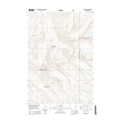
2014 Map of Mount Evans
USGS Topo · Published 2014About this map
The Continental Divide serves as the backbone of this high-altitude landscape in Deer Lodge County, where the peaks of Mt Evans and Mt Howe dominate the terrain. This 2014 survey documents a complex network of alpine hydrology, including Fourmile Basin Lakes, Lake of the Isle, and Miller Lake. The map illustrates the jurisdictional boundary where the Deerlodge National Forest meets the Beaverhead National Forest, reflecting long-standing federal land management in the Anaconda Range. Watercourses such as Storm Lake Cr and Tenmile Cr drain from the heights, while the presence of Nelson Gulch and Fourmile Basin indicates the glacial and erosional forces that have shaped these summits. For researchers, the map provides a contemporary record of the trails and stream systems that have defined this portion of the Montana Rockies for generations.
Find a feature on this map
27 named features on this map. Tap any name to fly to it.
Don’t see what you’re looking for? This feature index may not catch every label — zoom into the map to look around manually.
Map Details
Editions of this 2014 Mount Evans Map
This is the sole edition of this map. No revisions or reprints were ever made.
Other maps of this area

1908 · Philipsburg
USGS Topo · 1:125,000

1947 · Butte
USGS Topo · 1:250,000

1955 · Dillon
USGS Topo · 1:250,000

1957 · Dillon
USGS Topo · 1:250,000

1958 · Butte
USGS Topo · 1:250,000

1958 · Dillon
USGS Topo · 1:250,000

1960 · Butte
USGS Topo · 1:250,000

1962 · Butte
USGS Topo · 1:250,000

1962 · Dillon
USGS Topo · 1:250,000

1962 · Lincoln Gulch
USGS Topo · 1:24,000