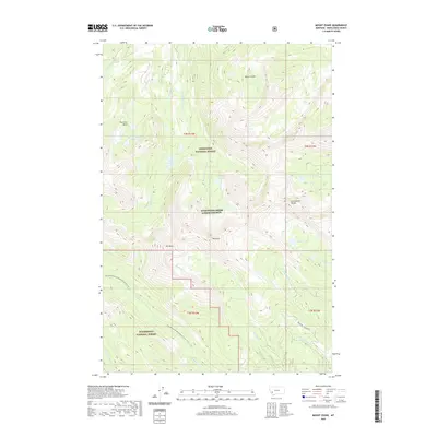
2020 Map of Mount Evans
USGS Topo · Published 2020About this map
Mt Evans and Mt Howe anchor the high-elevation landscape of this 2020 survey, marking the jagged spine of the Continental Divide in southwestern Montana. The terrain is defined by its dramatic relief and alpine hydrology, featuring a cluster of glacial basins that feed numerous headwater streams. The Continental Divide National Scenic Trail winds through the heart of the area, passing near Tenmile Lakes and the waters of the Lake of the Isle.
Find a feature on this map
30 named features on this map. Tap any name to fly to it.
Don’t see what you’re looking for? This feature index may not catch every label — zoom into the map to look around manually.
Map Details
Editions of this 2020 Mount Evans Map
This is the sole edition of this map. No revisions or reprints were ever made.
Other maps of this area

1908 · Philipsburg
USGS Topo · 1:125,000

1947 · Butte
USGS Topo · 1:250,000

1955 · Dillon
USGS Topo · 1:250,000

1957 · Dillon
USGS Topo · 1:250,000

1958 · Butte
USGS Topo · 1:250,000

1958 · Dillon
USGS Topo · 1:250,000

1960 · Butte
USGS Topo · 1:250,000

1962 · Butte
USGS Topo · 1:250,000

1962 · Dillon
USGS Topo · 1:250,000

1962 · Lincoln Gulch
USGS Topo · 1:24,000