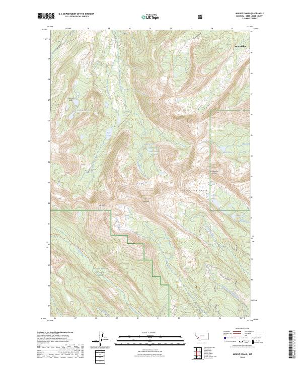
2024 Map of Mount Evans
USGS Topo · Published 2024About this map
The high peaks of the Anaconda Range dominate this 2024 landscape within the Deerlodge National Forest and Beaverhead National Forest. This high-altitude terrain is defined by the Continental Divide, which separates the drainages of Mill Creek and Seymour Creek. The preservation of the Anaconda Pintler Wilderness is evident in the southern portion of the map, where the Continental Divide National Scenic Trl winds through the mountains near Mt Evans and Mt Howe.
Find a feature on this map
31 named features on this map. Tap any name to fly to it.
Don’t see what you’re looking for? This feature index may not catch every label — zoom into the map to look around manually.
Map Details
Editions of this 2024 Mount Evans Map
This is the sole edition of this map. No revisions or reprints were ever made.
Other maps of this area

1908 · Philipsburg
USGS Topo · 1:125,000

1947 · Butte
USGS Topo · 1:250,000

1955 · Dillon
USGS Topo · 1:250,000

1957 · Dillon
USGS Topo · 1:250,000

1958 · Butte
USGS Topo · 1:250,000

1958 · Dillon
USGS Topo · 1:250,000

1960 · Butte
USGS Topo · 1:250,000

1962 · Butte
USGS Topo · 1:250,000

1962 · Dillon
USGS Topo · 1:250,000

1962 · Lincoln Gulch
USGS Topo · 1:24,000