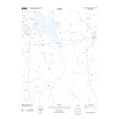
2013 Map of Mount Gilead West
USGS Topo · Published 2013About this map
Lake Tillery dominates the landscape at the confluence of the Pee Dee River and the Rocky River, where the borders of Stanly and Montgomery counties meet. The town of Norwood is well-established on the western shore, with the resort and residential areas of Norwood Beach stretching along the lakeside. Across the water to the east, Mount Gilead serves as a local hub, connected by roads that wind through the rural landscape. Smaller named settlements like Shankle, Fork Section, and Cedar Hill reflect the historically dispersed agricultural community of this river valley region.
Find a feature on this map
141 named features on this map. Tap any name to fly to it.
Don’t see what you’re looking for? This feature index may not catch every label — zoom into the map to look around manually.
Map Details
Editions of this 2013 Mount Gilead West Map
This is the sole edition of this map. No revisions or reprints were ever made.
Other maps of this area

1942 · Troy
USGS Topo · 1:125,000

1953 · Raleigh
USGS Topo · 1:250,000

1953 · Charlotte
USGS Topo · 1:250,000

1954 · Charlotte
USGS Topo · 1:250,000

1954 · Raleigh
USGS Topo · 1:250,000

1956 · Mangum
USGS Topo · 1:24,000

1956 · Mount Gilead East
USGS Topo · 1:24,000

1956 · Ansonville
USGS Topo · 1:24,000

1956 · Mount Gilead West
USGS Topo · 1:24,000

1957 · Albemarle
USGS Topo · 1:62,500