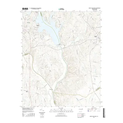
2016 Map of Mount Gilead West
USGS Topo · Published 2016About this map
Lake Tillery and the Pee Dee River dominate this Central North Carolina landscape, marking the convergence of several county boundaries. The town of Norwood sits on the western edge near the Rocky River, while Mount Gilead occupies the eastern high ground. The terrain is defined by its water systems, including the Little Pee Dee River and numerous tributaries like Clarks Cr and Buffalo Cr. Local geography is further highlighted by prominent landmarks such as Morgan Mtn and Buzzard Island.
Find a feature on this map
101 named features on this map. Tap any name to fly to it.
Don’t see what you’re looking for? This feature index may not catch every label — zoom into the map to look around manually.
Map Details
Editions of this 2016 Mount Gilead West Map
This is the sole edition of this map. No revisions or reprints were ever made.
Other maps of this area

1942 · Troy
USGS Topo · 1:125,000

1953 · Raleigh
USGS Topo · 1:250,000

1953 · Charlotte
USGS Topo · 1:250,000

1954 · Charlotte
USGS Topo · 1:250,000

1954 · Raleigh
USGS Topo · 1:250,000

1956 · Mangum
USGS Topo · 1:24,000

1956 · Mount Gilead East
USGS Topo · 1:24,000

1956 · Ansonville
USGS Topo · 1:24,000

1956 · Mount Gilead West
USGS Topo · 1:24,000

1957 · Albemarle
USGS Topo · 1:62,500