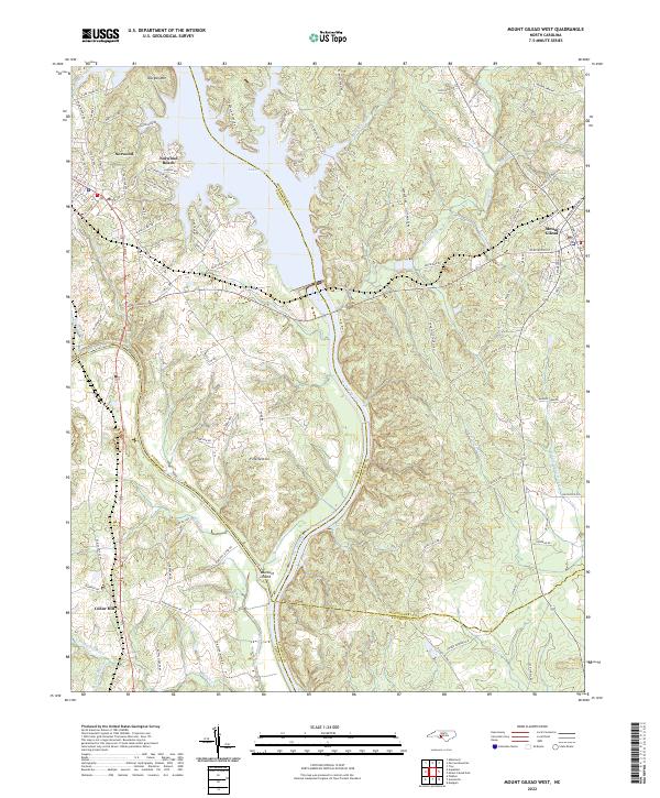
2022 Map of Mount Gilead West
USGS Topo · Published 2022About this map
The Pee Dee River and its expansive reservoir, Lake Tillery, form the central axis of this modern survey of the North Carolina Piedmont. The landscape is defined by the convergence of four counties—Stanly, Montgomery, Anson, and Richmond—where the river marks the traditional boundary. To the west, the town of Norwood is well-established with its Norwood Town Hall, Norwood PO, and local institutions like Norwood Sch and Norwood Ch. The railway corridor of the Winston-Salem Southbound RR tracks through this western section, providing a clear reference for genealogical research near the Norwood Cem.
Find a feature on this map
120 named features on this map. Tap any name to fly to it.
Don’t see what you’re looking for? This feature index may not catch every label — zoom into the map to look around manually.
Map Details
Editions of this 2022 Mount Gilead West Map
This is the sole edition of this map. No revisions or reprints were ever made.
Other maps of this area

1942 · Troy
USGS Topo · 1:125,000

1953 · Raleigh
USGS Topo · 1:250,000

1953 · Charlotte
USGS Topo · 1:250,000

1954 · Charlotte
USGS Topo · 1:250,000

1954 · Raleigh
USGS Topo · 1:250,000

1956 · Mangum
USGS Topo · 1:24,000

1956 · Mount Gilead East
USGS Topo · 1:24,000

1956 · Ansonville
USGS Topo · 1:24,000

1956 · Mount Gilead West
USGS Topo · 1:24,000

1957 · Albemarle
USGS Topo · 1:62,500