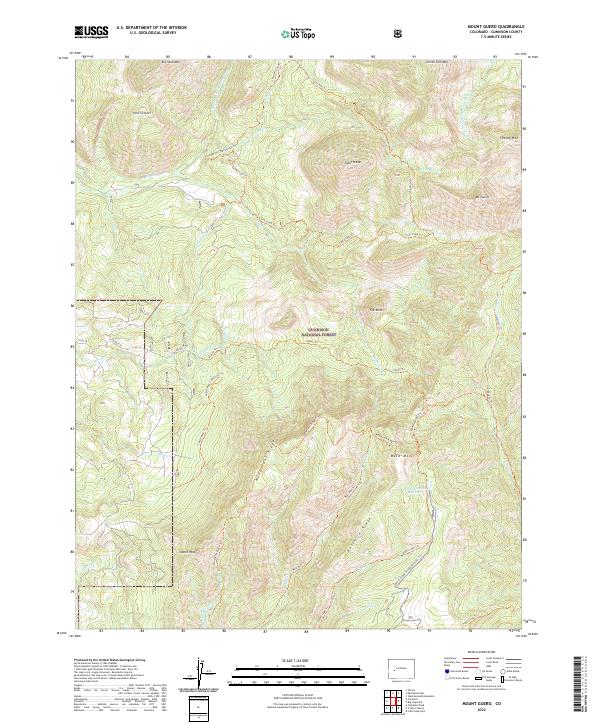
2022 Map of Mount Guero
USGS Topo · Published 2022About this map
Gunnison National Forest dominates this high-altitude landscape, where deep drainages like the N Smith Fork Gunnison River and Curecanti Cr carve through a complex system of ridges and peaks. The map reveals a land defined by water management and recreational access, featuring the Virginia Ditch and Grand View Ditch alongside the Bald Mountain Reservoir. Notable peaks such as Mt Guero, Tater Heap, and the prominent Castle Rock provide dramatic vertical relief across the quadrangle. An extensive network of backcountry routes, including the Mendicant Ridge Trl and the specialized Crystal Creek Snowmobile/Ski Trl, suggests the area's importance for both summer trekking and winter sports within the national forest system.
Find a feature on this map
51 named features on this map. Tap any name to fly to it.
Don’t see what you’re looking for? This feature index may not catch every label — zoom into the map to look around manually.
Map Details
Editions of this 2022 Mount Guero Map
This is the sole edition of this map. No revisions or reprints were ever made.
Other maps of this area

1938 · Mt. Gunnison
USGS Topo · 1:48,000

1945 · Mount Gunnison
USGS Topo · 1:62,500

1954 · Little Soap Park
USGS Topo · 1:24,000

1956 · Montrose
USGS Topo · 1:250,000

1957 · Cathedral Peak
USGS Topo · 1:24,000

1957 · X Lazy F Ranch
USGS Topo · 1:24,000

1959 · Montrose
USGS Topo · 1:250,000

1960 · Montrose
USGS Topo · 1:250,000
1964 · West Beckwith Peak
USGS Topo · 1:24,000

1964 · Minnesota Pass
USGS Topo · 1:24,000