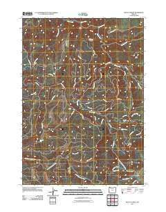
2011 Map of Mount Gurney
USGS Topo · Published 2011About this map
Mount Gurney stands as a prominent landmark in this 2011 topographic study of Douglas County, where the high ridges of the Oregon Coast Range divide numerous drainage basins. The southern portion of the map is defined by the East Fork Coquille River and the historic Coos Bay Wagon Rd, a route central to the development of the region's interior. This corridor passes near Iverson Memorial County Park, providing a rare point of public recreation amidst a landscape dominated by timber management and fire-access routes such as the extensive Bureau of Land Management road network.
Find a feature on this map
47 named features on this map. Tap any name to fly to it.
Don’t see what you’re looking for? This feature index may not catch every label — zoom into the map to look around manually.
Map Details
Editions of this 2011 Mount Gurney Map
This is the sole edition of this map. No revisions or reprints were ever made.
Other maps of this area

1928 · Sitkum
USGS Topo · 1:125,000

1955 · Camas Valley
USGS Topo · 1:62,500

1955 · Ivers Peak
USGS Topo · 1:62,500

1955 · Sitkum
USGS Topo · 1:62,500

1955 · Tyee
USGS Topo · 1:62,500

1958 · Roseburg
USGS Topo · 1:250,000

1959 · Roseburg
USGS Topo · 1:250,000

1979 · Roseburg
USGS Topo · 1:100,000
1990 · Cedar Creek
USGS Topo · 1:24,000
1990 · Tenmile
USGS Topo · 1:24,000