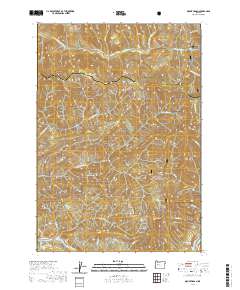
2020 Map of Mount Hagan
USGS Topo · Published 2020About this map
Mt Hagan stands as a prominent topographical feature within the Willamette National Forest, anchoring a landscape defined by the drainage systems of the Cascade Range. This 2020 map details the transition from the McKenzie River valley in the south to the high ridges of the Linn and Lane County line. The settlement of Finn Rock is situated along the southern edge, where Goodpasture Rd follows the river corridor. The map reveals an intricate network of timber and access roads, such as Natl Forest Develop Road 2820 Rd, which navigate the steep elevations between Elk Mtn and Jimbo Mtn. Numerous watercourses, including the Calapooia River and its northern fork, carve through the forest, while minor tributaries like Wet Gulch and Doris Cr highlight the region's dense hydrography.
Find a feature on this map
35 named features on this map. Tap any name to fly to it.
Don’t see what you’re looking for? This feature index may not catch every label — zoom into the map to look around manually.
Map Details
Editions of this 2020 Mount Hagan Map
This is the sole edition of this map. No revisions or reprints were ever made.
Other maps of this area

1934 · Mc Kenzie Bridge
USGS Topo · 1:96,000

1940 · Mc Kenzie Bridge
USGS Topo · 1:125,000

1951 · Sweet Home
USGS Topo · 1:62,500

1951 · Leaburg
USGS Topo · 1:62,500

1953 · Salem
USGS Topo · 1:250,000

1954 · Salem
USGS Topo · 1:250,000

1955 · Blue River
USGS Topo · 1:62,500

1955 · Cascadia
USGS Topo · 1:62,500

1960 · Salem
USGS Topo · 1:250,000

1962 · Salem
USGS Topo · 1:250,000