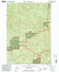
1997 Map of Mount Hagan
USGS Topo · Published 2001About this map
The Willamette National Forest dominates this section of the Cascades, where the Linn Co Lane Co boundary line traverses high ridges between major river systems. To the north, the Calapooia River and its tributary, the North Fork Calapooia River, carve deep valleys near King Camp. The southern portion of the map transitions toward the McKenzie River corridor, featuring the riverside settlement of Finn Rock and the protected grounds of Howard J Morton State Park. Significant elevations such as Mount Hagan, Elk Mountain, and Jimbo Mountain define the drainage patterns for numerous creeks, including Gate Creek and United States Creek. The map documents a managed forest landscape in the late 1990s, interlaced with 4wd tracks and forest roads that provide access to these remote watersheds.
Find a feature on this map
23 named features on this map. Tap any name to fly to it.
Don’t see what you’re looking for? This feature index may not catch every label — zoom into the map to look around manually.
Map Details
Editions of this 1997 Mount Hagan Map
This is the sole edition of this map. No revisions or reprints were ever made.
Other maps of this area

1934 · Mc Kenzie Bridge
USGS Topo · 1:96,000

1940 · Mc Kenzie Bridge
USGS Topo · 1:125,000

1951 · Sweet Home
USGS Topo · 1:62,500

1951 · Leaburg
USGS Topo · 1:62,500

1953 · Salem
USGS Topo · 1:250,000

1954 · Salem
USGS Topo · 1:250,000

1955 · Blue River
USGS Topo · 1:62,500

1955 · Cascadia
USGS Topo · 1:62,500

1960 · Salem
USGS Topo · 1:250,000

1962 · Salem
USGS Topo · 1:250,000